Category:Russian-language maps showing history of Europe
Jump to navigation
Jump to search
Media in category "Russian-language maps showing history of Europe"
The following 71 files are in this category, out of 71 total.
-
 1600 rus.png 7,000 × 4,957; 2.39 MB
-
 SAPUNOV(1893) -03- p023.jpg 2,387 × 2,031; 2.47 MB
-
 Args04.png 1,113 × 693; 264 KB
-
 Austro-prussian-war-1866-combined.png 1,694 × 5,000; 3.87 MB
-
 Austro-prussian-war-1866.png 2,981 × 2,995; 237 KB
-
 Bellum Gallicum 2 (57) animation.gif 810 × 865; 814 KB
-
 Bellum Gallicum 3 (56) animation.gif 810 × 865; 597 KB
-
 Bellum Gallicum 4 (55) animation.gif 810 × 865; 338 KB
-
 Bellum Gallicum 5 (54) animation.gif 810 × 865; 357 KB
-
 Bellum Gallicum 6 (53) animation.gif 810 × 865; 319 KB
-
 Bellum Gallicum 7 (52) animation.gif 810 × 865; 315 KB
-
 Bellum Gallicum animation (lite version).gif 810 × 865; 422 KB
-
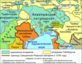
 BlackSea region.svg 1,771 × 1,254; 211 KB
-
 Boeotia.svg 1,200 × 900; 487 KB
-
 Caesar Spanish camp.png 212 × 175; 4 KB
-
 Chalkidian league.jpg 1,000 × 705; 336 KB
-
 Cimbrian war map ru.jpg 704 × 598; 222 KB
-
 Civil War in Roman Republic 31 BC (before Actium).png 1,077 × 790; 217 KB
-
 Civil War in Roman Republic 44-43 BC (Mutina and Forum Gallorum).png 1,000 × 697; 269 KB
-
 Deutscher Bund-1866-ru.png 2,981 × 2,835; 240 KB
-
 Eastern slavonia 91-92 map -ru.jpg 1,821 × 1,350; 627 KB
-
 EasternBloc BasicMembersOnly Rus.svg 404 × 612; 842 KB
-
 Environs of Athens-ru.svg 910 × 1,000; 553 KB
-
 Europe 1848 map ru.png 2,284 × 1,503; 1.23 MB
-
 Gerdarika Pskov Map 1462.jpg 1,426 × 1,422; 558 KB
-
 Germany-post-1866-war.png 2,981 × 2,995; 244 KB
-
 Great Greece.jpg 591 × 591; 221 KB
-
 Greecemap.svg 983 × 751; 112 KB
-
 History of France-1.jpg 671 × 1,085; 99 KB
-
 History of France-2.jpg 1,352 × 1,064; 183 KB
-
 History of France-3.jpg 666 × 1,061; 83 KB
-
 HolyRomanEmpire 1618 russian.png 4,005 × 3,967; 3.41 MB
-
 Kleitor.png 1,458 × 1,548; 217 KB
-
 Lombard state 526-ru.png 1,851 × 1,098; 277 KB
-
 Mantinea.jpg 1,458 × 1,548; 944 KB
-
 Map Frank campaigns in Aquitaine 507-509-ru.png 1,594 × 1,655; 541 KB
-
 Map Gaul 481-511-ru.png 1,600 × 1,661; 626 KB
-
 Map Gaul divisions 511-ru.png 1,600 × 1,661; 675 KB
-
 Map of ancient Pylos-ru.svg 304 × 304; 580 KB
-
 Map of Mycenaean roads and bridges-ru.svg 392 × 392; 2.42 MB
-
 Megalopolis (Peloponnes).png 1,458 × 1,548; 217 KB
-
 Peloponnes and Middle Greece.png 1,772 × 2,028; 332 KB
-
 Potidaea.png 1,000 × 705; 92 KB
-
 RuskieIRP1-ru.PNG 2,000 × 1,564; 944 KB
-
 Russian history of the Baltic Sea, 1712-1721.jpg 1,571 × 1,894; 468 KB
-
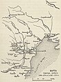 Russian map of 18th century war in Moldova.jpg 1,098 × 1,478; 218 KB
-
 Russian map of Serbia in the year 1389.jpg 1,573 × 1,791; 355 KB
-
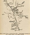
 Russian map of Ukraine showing 1695-1711.jpg 1,514 × 1,557; 235 KB
-
 Second World War Europe 1939 map ru.png 960 × 1,000; 82 KB
-
 Serbia in the Yugoslav Wars - ru.png 1,285 × 892; 205 KB
-
 Сербия 1941-1944.jpg 503 × 724; 149 KB
-
 Social war 91 88.png 260 × 170; 6 KB
-
 Steinstücken Cold War map (ru).svg 1,468 × 1,546; 551 KB
-
 Stymphalos.png 1,458 × 1,548; 213 KB
-
 Umritt Heinrich II (ru).png 1,381 × 1,909; 168 KB
-
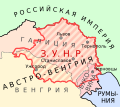 West Ukrainian People's Republic map.svg 540 × 480; 147 KB
-
 WWII - The War of Lines (RU).svg 756 × 800; 2.82 MB
-
 WWll европа map. jpg.jpg 1,200 × 1,001; 315 KB
-
 Авзоны-и-мессапы.jpg 1,024 × 1,166; 39 KB
-
 Аквилейский-патриархат-1378.png 700 × 547; 358 KB
-
 Балканы в 1878.jpg 1,740 × 1,370; 797 KB
-
 Берлинская Операция.jpg 1,420 × 872; 297 KB
-
 Блатенское княжество.png 780 × 505; 26 KB
-
 Бои в Ла-Манше в апреле 1944.jpg 800 × 496; 43 KB
-

-
 Карта Богемии при Карле IV ру.png 1,646 × 1,642; 285 KB
-

-

-
 Линия "Диль".jpg 1,378 × 894; 252 KB
-
 Народонаселеніе и языки ЕВРОПЫ 1907 С-П. РИ..jpg 1,000 × 931; 371 KB
-
 Народы Восточной Европы.jpg 742 × 707; 237 KB

_-03-_p023.jpg)


_animation.gif)
_animation.gif)
_animation.gif)
_animation.gif)
_animation.gif)
_animation.gif)
.gif)


.png)
.png)


.png)


.svg)

.png)

.svg)


.jpg)

.jpg)


